
Grey Fleet Ship-to-Ship Oil Transfers: Heightened Safety and Environmental Risks at Sea
The term “Grey Fleet” has emerged to describe a loosely regulated class of vessels, typically older ships with complex ownership and flag structures. These ships operate outside conventional industry standards, often engaging in sanctioned cargo movements and risky ship-to-ship (STS) transfers. Unlike vessels regulated by IMO member states, which are subject to rigorous inspections and robust insurance, the Grey Fleet operates with lax oversight. This results in neglected maintenance, substandard crew training, and disregard for safety, posing significant risks to both seafarers and the environment.
The Laconian Gulf in Greece, known for its calm waters, is a frequent location for STS transfers. The International Maritime Organisation (IMO) requires all vessels to notify coastal authorities 48 hours in advance of such operations to ensure safety and prevent pollution. Additionally, the Mediterranean Sea is designated as a MARPOL Annexe I Special Area, subjecting the Laconian Gulf to stringent environmental protection measures.
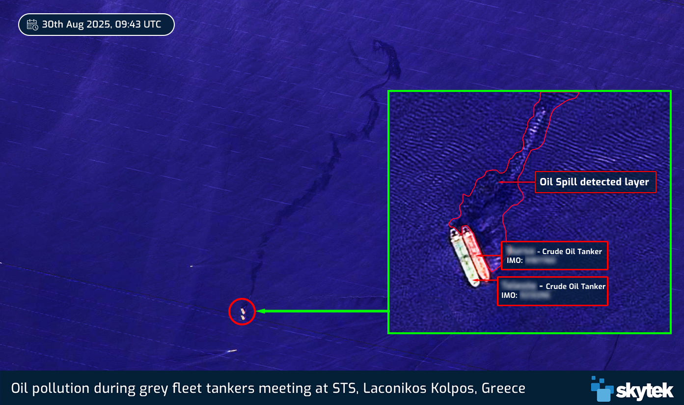
On August 30th, two Grey Fleet crude oil tankers conducted an STS transfer in the Laconicos Kollpos, Greece. Satellite imagery analysed by Skytek captured a significant oil spill during the operation, with the pollution trace spreading across an 8-square-kilometre area, highlighting the environmental threat posed by these unregulated vessels.
The Skytek Real World platform is a cutting-edge maritime analytics solution that, amongst other strengths, closely monitors global maritime trade, with a strong focus on identifying suspicious activities linked to the grey fleet. Leveraging advanced satellite data, Automatic Identification System (AIS) signals, and machine learning algorithms, Skytek provides near real-time visibility into vessel movements, cargo operations, and trading patterns. The platform aggregates a vast array of data points—from ship specifications and voyage histories to port calls and cargo operations—enabling the creation of detailed ship profiles.


