Reports & Events

Marine

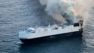
Morning Midas Fire incident

Morning Midas is a Liberian-registered car carrier built in 2006, managed by UK-based Zodiac Maritime. The vessel has a capacity of nearly 5,000 vehicles across 12 decks and specialises in transporting a mix of conventional, hybrid, and electric vehicles on global routes between Asia and the Americas. On its most recent voyage, Morning Midas was carrying a large consignment of vehicles—including electric models—when a fire broke out onboard, reportedly originating from a deck with electric vehicles and suspected to involve lithium-ion batteries.

Read More »
Marine

Superyacht Aggregation – Monaco Grand Prix

The iconic Formula 1 race transforms Monaco’s harbour into a spectacular floating luxury marina, attracting some of the world’s largest and most prestigious superyachts. These yachts offer exclusive vantage points for race viewing, seamlessly blending the thrill of high-performance motorsport with the sophistication of the high-end yachting lifestyle. The Monaco Grand Prix weekend, which this year happened from 22nd to 25th May, has seen a dense aggregation of pleasure boats and superyachts concentrated near the circuit.

Read More »
Damage Assessment

North Sea Collision

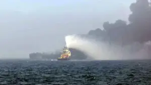
On Monday, March 10, 2025, a collision occurred between the US-flagged oil tanker MV Stena Immaculate and the Portugal-flagged container ship Solong in the North Sea near Grimsby, off the coast of East Yorkshire, UK. The incident resulted in fires on both vessels and a large-scale rescue operation.

Read More »
Damage Assessment

Los Angeles Wildfires

Wildfires are a significant and growing concern in the United States, with an average of 70,025 fires burning approximately 7 million acres annually in the past decade. Climate change and increased development in wildland-urban interface areas have exacerbated the frequency and intensity of wildfires, leading to longer fire seasons and more destructive blazes across the country

Read More »
Damage Assessment

Hurricane Milton Damage Assessment

In the wake of Hurricane Milton, Skytek’s innovative machine learning system has transformed how damage assessments are conducted for insurers, providing crucial information quickly. As Hurricane Milton devastated coastal areas, causing widespread destruction, insurers needed immediate and accurate assessments to evaluate the scale of property damage. Skytek’s technology, combining advanced algorithms and real-time satellite imagery, became an indispensable tool, delivering critical loss data just 48 hours after the storm passed.

Read More »
Severe Weather

Hurricane Milton

Less than two weeks after Hurricane Helene caused significant destruction in the Southeast, Tropical Storm Milton has quickly formed in the Gulf of Mexico and is barrelling towards Tampa, Florida where it is forecasted to land as a Category 3 Hurricane.
The majority of offshore assets are located to the north; however, this path places a cluster of holiday resorts and hotels directly in the line of hurricane-force winds, intense rainfall, and storm surges. Additionally, there are 11 cruise ships valued at $2.7 billion within the hurricane’s cone, with three currently departing to evade the storm.

Read More »
Hurricane

Hurricane “Helene” – Damage Assessment

Skytek utilised aerial imagery captured on August 12th, 2024, and September 28th, 2024, shortly after Hurricane Helene made landfall near Perry, Florida. Skytek applied its proprietary machine learning algorithm to detect, highlight, and quantify the damage inflicted by the hurricane. The platform ingested aerial images from relevant areas along the hurricane’s trajectory, analysing the impact of the storm surge and flooding, along with wind damage.

Read More »
Hurricane

Hurricane “Helene”

Hurricane Helene is the ninth hurricane of the 2024 Atlantic hurricane season. It has rapidly intensified from a tropical storm on September 24th and is expected to reach Category 3 major hurricane status, with forecasts indicating sustained winds of at least 125 mph as it approaches the Florida Gulf Coast. The storm is currently advancing in a north-northwest direction and is anticipated to make landfall in Florida’s Big Bend region on Thursday evening, potentially near Mexico Beach and Cedar Key. Given its large size, there are concerns about extensive impacts, including a significant storm surge and flooding. The National Hurricane Center has warned of possible surge heights between 10 to 15 feet in the Big Bend area, which could lead to severe flooding.

Read More »

Login