
SUMMARY
Maui, within Hawaii’s Central Pacific archipelago, faces recurrent wildfires triggered by the convergence of arid conditions, intense winds, and the proliferation of nonnative grasses, potentially exacerbated by hurricane-related influences.
On August 8th, the US National Weather Service issued alerts for high winds and dry conditions in the Hawaiian Islands. A brush fire was reported in Kula, approximately 35 miles (56 km) from Lahaina, rapidly spreading towards Lahaina fueled by strong winds associated with Hurricane Dora.
Skytek analysed the status of a property located at the address 611 Front Street, Lahaina, Maui. The property was identified as King Kamehameha III Elementary School and is located in coordinates: 20°52’13.9″N 156°40’37.1″W
The property has been ingested in the Skytek’s intelligence platform, to perform an analysis of its status using satellite imagery acquired before the fire damage and comparing the status of the same property using satellite imagery acquired post-event. This analysis provides information on any changes identified in the images, including a qualitative description of the observed damage.
The results and findings of this analysis are provided below.
OVERVIEW
The property located at 611 Front Street, in Lahaina, Maui, is identified as one of the two school buildings in Lahaina. It was founded in 1880 and is located on the corner of Dickenson and Honoapiilani Highways, receiving pupils from the kindergarten to fifth grade.
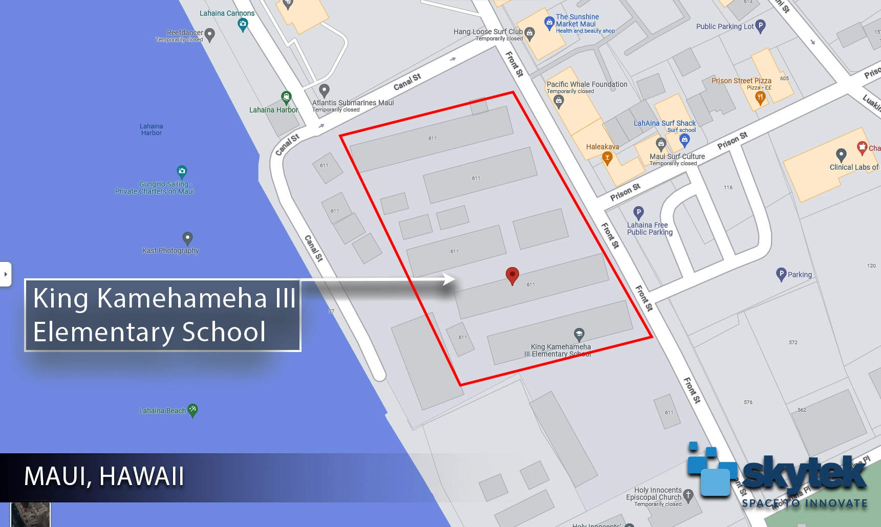
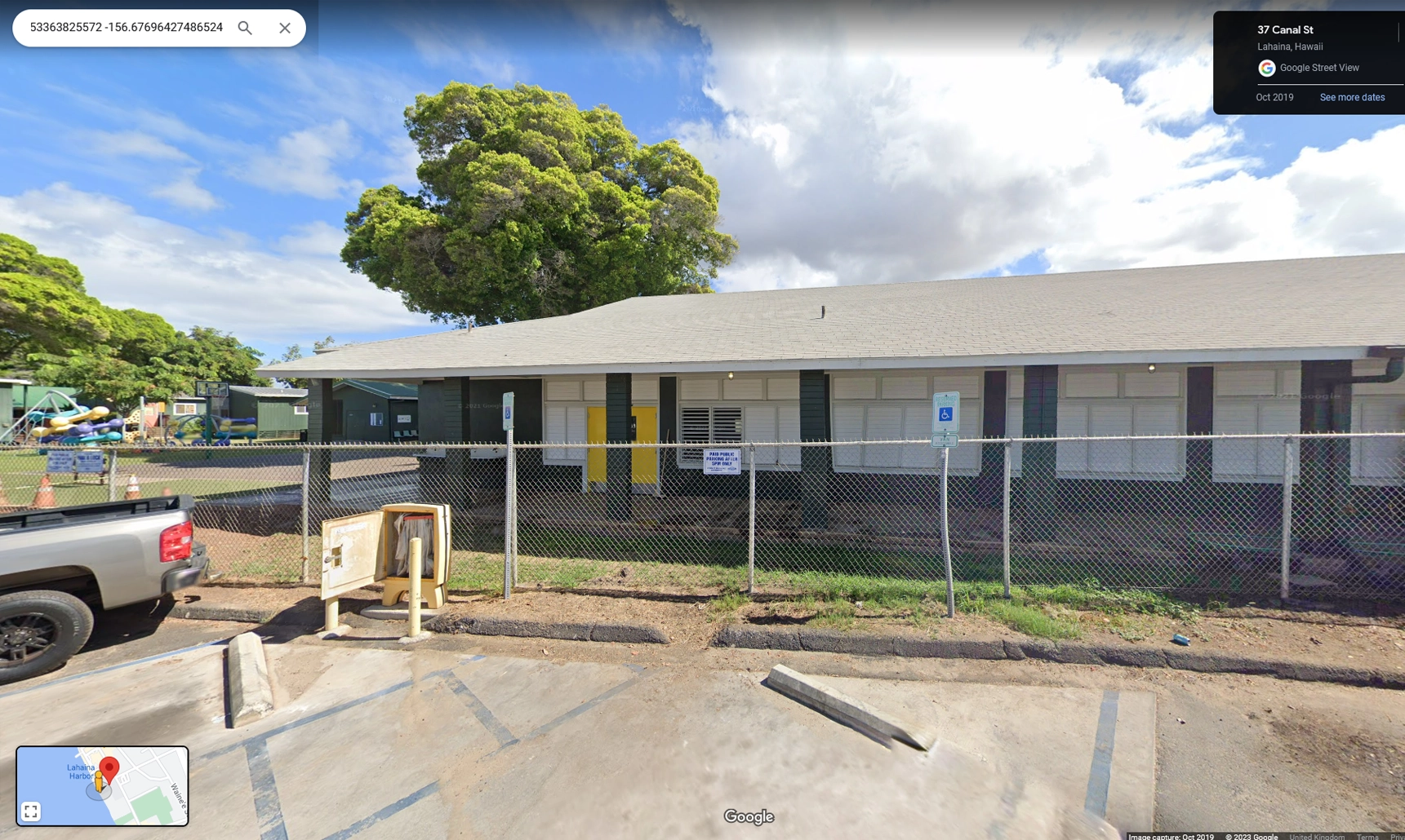
A visual representation of the property of interest is provided in the map below Figure 1 where the property of interest is highlighted in red, as well as in the “street view” Figure 2.
PROPERTY ANALYSIS
The Situation Room platform is able to quickly analyse a large area and return the assessment results for thousands of properties in a tabular view, giving a complete condition status overview of the analysed properties and, empowering the user to analyse in granular detail each particular property and submit a condition assessment report.
One of the properties listed above at the address 611 Front St, Lahaina, HI 96761, USA in coordinates: 20.8715º N 156.6773º W is identified as King Kamehameha III Elementary School, one of the two schools in Lahaina town.
Satellite imagery for February 02nd 2023 provides a reference for the ML model to benchmark with the post-event high-resolution imagery to detect, highlight and quantify the changes associated with the wildfire event. The pre-event high-resolution imagery is displayed in Figure 3.
To analyse the impact of the wildfires on the property of interest, high-resolution satellite imagery was acquired for August 15th 2023 and is displayed in Figure 4 below:
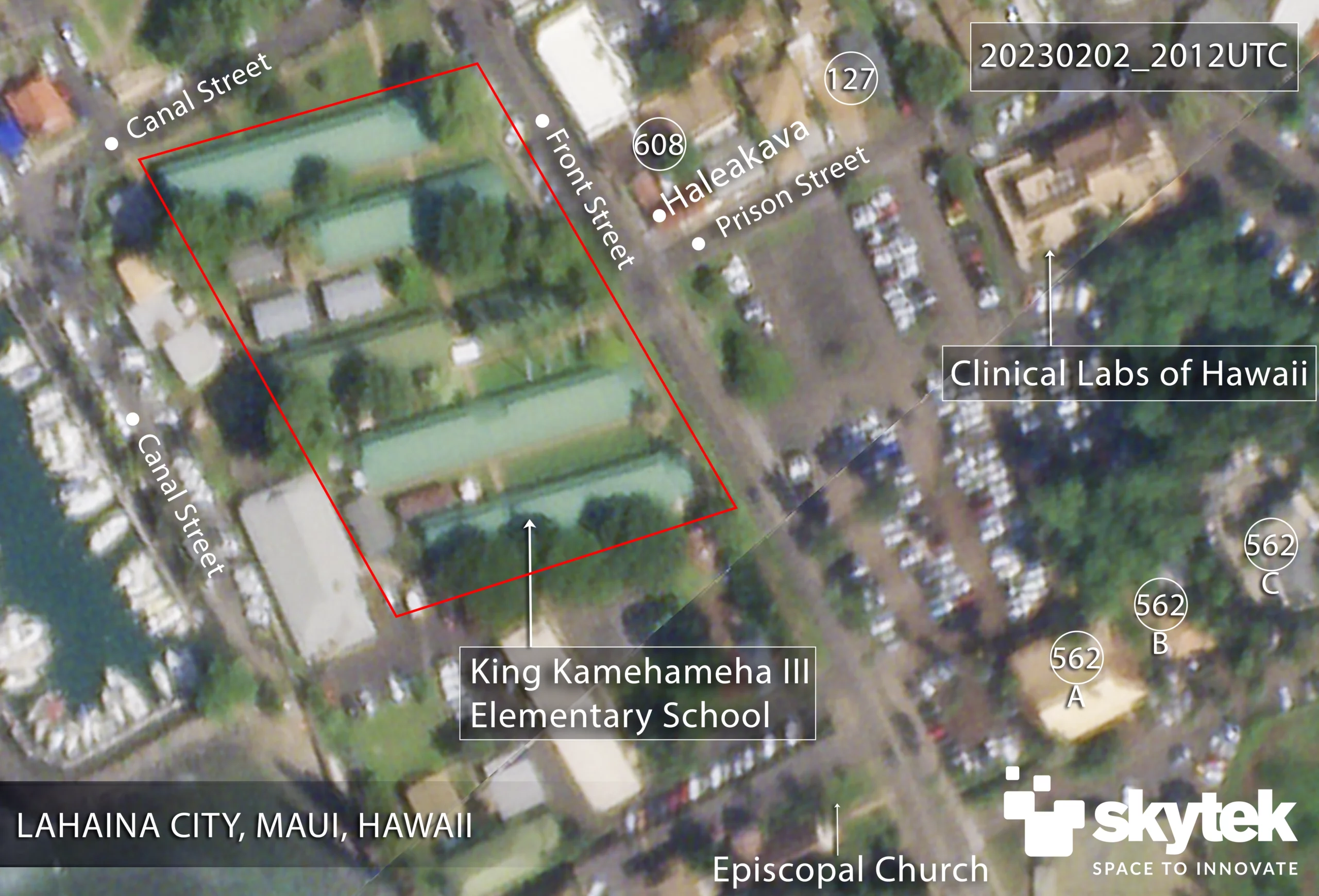
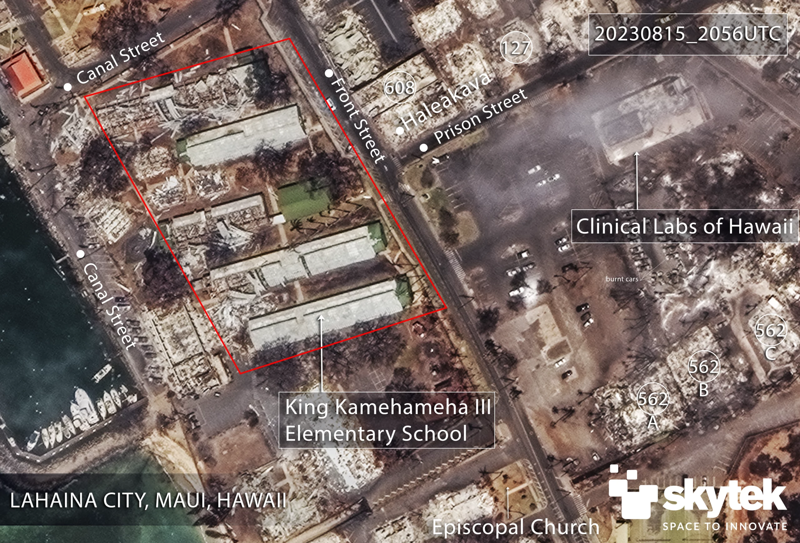
Figure 3 – 611 Front Street, Lahaina on February 02nd, 2023, Planet Labs
Figure 4 – 611 Front Street, Lahaina on August 15th, 2023, Digital Globe
Comparing these two acquisitions, the following observations can be made about the property at 611 Front Street:
- The overall surrounding area indicates an extensive level of destruction through burning or exposure to heat and smoke
- Trees and bushes initially surrounded the property, but the satellite imagery indicates that after August 08th, most of the trees and the vegetation surrounding 611 Front Street were burned
- Satellite imagery in Figure 4 shows that the King Kamehameha III Elementary School (611 Front Street) sustained significant fire and smoke damage.
- The surrounding trees are burned and scorched, and the fire appears to have spread from the east across Front Street, causing more damage to the northern buildings of the school.
- Seven of the eleven school buildings have burned to the ground and collapsed, and the remaining four buildings are observed structurally damaged due to fire, smoke, and flying debris.
- A large number of cars in the Lahaina public parking lot and near the school have also been destroyed.
- The electricity poles are observed collapsed and burnt, and it is expected the area is under loss of electrical power
- The analysis of imagery in Figure 4 indicates the status of surrounding buildings as follows:
- LahAina Surf Shack structure at 117 Prison St. is completely destroyed
- Haleakava structure at 602 Front Street is completely destroyed
- Prison Street Pizza structure at 133 Prison Street is completely destroyed
- Keiki Bowls Café structure at 117 Prison Street is completely destroyed
- Clinical Labs of Hawaii structure at 130 Prison Street is significantly affected by the fire, and the Skytek model indicates 72% damage
- Holy Innocents Episcopal Church and School at 561 Front Street structure is completely destroyed and collapsed
- The residences at 562 Front Street are burnt to the ground and destroyed
- Satellite imagery in Figure 4 depicts significant destruction of the structures at 611 Front Street, consistent with the 81% damage detected by the ML property damage.
- The buildings in the immediate vicinity are burned down and destroyed by fire
- Satellite imagery indicates the roads are blocked with burnt cars and still not open for traffic as of August 11th, 2023
- The King Kamehameha III Elementary School located at 611 Front Street, Lahaina, is significantly damaged by the August 2023 wildfires.


